While triple-digit temperatures are nothing new to residents of California’s Central Valley, it’s never a bad idea to remind folks how to get ready for an extended heat wave.
So far, the summer of 2023 has been a fairly mild one. Triple-digit temperatures didn’t arrive until late June, and after two 100-plus scorchers on July 2-3, the temperatures retreated into the low 80s a week later.
But, let’s face it, we all knew a heat wave was out there lurking. It was never a matter of “if,” only “when.”
“When” arrives this weekend.
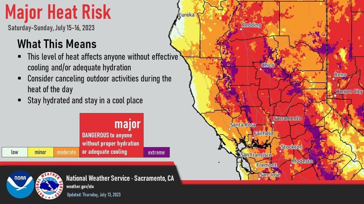
Following Friday’s high of 102 degrees, today is forecast to be 107 degrees, with Sunday expected to be the hottest day of year so far, at 109 degrees. It will be more of the same early next week before the mercury dips below 100 — barely — on Wednesday
“Hopefully, by Wednesday, we’ll be down below 100 degrees,” said Sara Purdue, a meteorologist with the National Weather Service in Sacramento. “But it will hover in the high 90s.”
After a brief break from triple-digit temperatures, we could get more by the end of the week.
“There’s a ridge (an area of high pressure) over California currently and that’s what’s bringing in all the hot temperatures,” said Purdue. “There’s a small trough (area of low pressure) that will pass over starting Monday, which is why the temperatures will come back down. But there’s another ridge building up later in the week. So, we’ll see some slight cooling, but then it’ll be warming up again.”

The Stanislaus County Health Services Agency warns that heat presents a it will health risk, particularly for vulnerable populations such as young children, the elderly, individuals with chronic illnesses or disabilities, and pregnant women. The department has issued tips for staying safe:
Stay hydrated — Drink plenty of water throughout the day, even if you do not feel thirsty. Avoid excessive caffeinated or alcoholic beverages, as they can contribute to dehydration.
Seek cool environments — If you don’t have air conditioning in your home, spend time in places such as malls, libraries, or community centers, especially during the hottest parts of the day. Or consider visiting a cooling zone in your area.
Limit outdoor activity — Minimize strenuous outdoor activities, especially during peak heat hours between 10 am and 4 pm. If you must be outside, wear lightweight, loose-fitting clothing, and use sunscreen with a high SPF to protect your skin from the sun's rays.
Check on vulnerable individuals — Keep an eye on elderly neighbors, young children, and those with chronic illnesses or disabilities. Ensure they have access to cool environments and are properly hydrated.
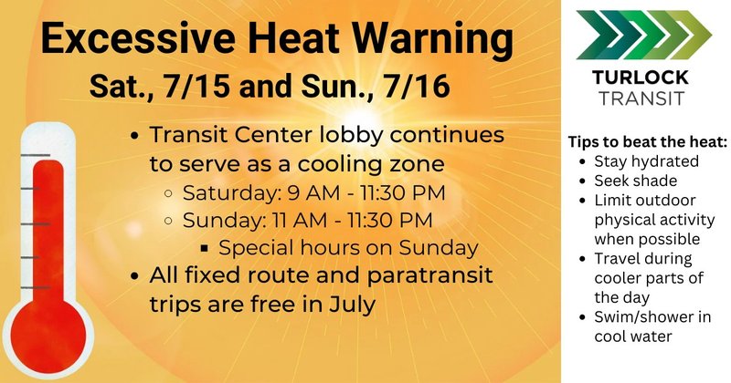
The city of Turlock will be operating cooling centers at the Roger K. Fall Transit Center, 1418 N. Golden State Blvd., and at the Turlock Public Library, 550 Minaret Ave.
The Transit Center will be open today from 9 a.m. to 11:30 p.m., and on Sunday from 11 a.m. to 11:30 p.m. Weekdays, the cooling zone operates from 6 a.m. to 9 p.m.
The library will be open today from 10 a.m. to 5 p.m.
Those seeking relief from the heat can board any fixed route bus for transportation to the Transit Center. Regular fares will waived upon passenger’s request during an excessive heat warning.


