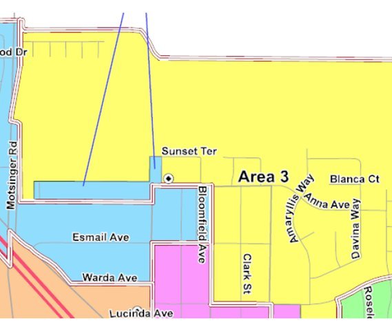
The Turlock Unified School District Board of Trustees approved a new district map at Tuesday's meeting after much deliberation and public input over the past few months. The board went with the “Teal Map” which, according to Assistant Superintendent Barney Gordon, was the most popular among community members who weighed in.
“This map was well received,” said Gordon. “A lot of folks encouraged the board to make sure the process was transparent and try to even out the distribution.”
The criteria the board tries to follow when drawing boundaries are: Have the population distribution between areas below 10 percent deviation; create compact, contiguous, easily identifiable boundaries that keep communities of interest together; and create minority opportunity districts as required by law.
Area one encompasses the north of the town and goes up to E. Grayson Avenue. It goes to Fulkerth Road and goes as far east as N. Walnut Road. The area has a total population of 11,968 and doesn’t have a citizen total or voting majority population of any ethnicity.
Area two covers the high population area near Stanislaus State. It covers a lot of Christoffersen Parkway and borders E. Tuolumne Road. District two has a total population of 11,669 with having a majority white total and citizen voting population.
Area three starts at N. Golden State Boulevard and goes all the way down to S. Faith Home Road to the west and Lombardy Street on the East. This area has a total population of 12,192 with no majority ethnicity in the total population, but has a majority citizen voting white population.
Area four covers the east part of Turlock and starts on E. Tuolumne Road and goes down to W. Harding Road. From West to East, it starts near E. Canal Drive and goes to W. East Avenue. Area four has a total population of 12,492 with a majority white total and citizen voting population.
Area five is another high population district near Main Street. It borders West Avenue and E. Canal Drive near Turlock High School. District five has a total population of 12,164 with a majority Hispanic total population and white citizen voting population.
Area six is the largest geographic district and covers a lot of the west side of town before Golden State Boulevard. From West to East, it goes all the way from W. Fulkerth Road to Golden State Boulevard and it travels Fulkerth all the way south to American Avenue. This area has a total population of 11,770 with no ethnicity as a total majority and a white citizen voting majority population.
Area seven covers a lot of south Turlock starting at N. Golden State Boulevard and going all the way down to Swanson Road. From West to East, it starts on S. Faith Home Road and goes across town to N. Lombardy Street. This is the largest district with a total population of 12,603 and a majority Hispanic total and citizen voting population.


